Humanitarian logistics and the role of social media
Vincent Fevrier, @FevrierVincent
Im a current student of International Disaster Management at the HCRI, and on 14 September, I presented my dissertation research at the Quest for Humanitarian Effectiveness conference run by HCRI, Save the Children, and under the umbrella of the World Humanitarian Summit. This was a tremendous opportunity for me to present to such an accomplished audience. My research focuses on how social media and crisis mapping can work together to provide the situational awareness necessary to make humanitarian logistics more efficient. I had this idea even before coming to the HCRI, but was encouraged and supported by my studies of Emergency Humanitarian Assistance, and Integrated Disaster Preparedness and Response.
Humanitarian logistics has only been recognized in the last decade after the coordination issues of the response to the 2004 Indian Ocean Tsunami, and compared to its counterpart in the private sector, is quite far behind in terms of systems and efficiency. One reason is because the humanitarian sector doesnt evolve as quickly in terms of using new technologies. Paper and pencil is still a preferred method, and in disaster zones, there is often limited connectivity to the internet or mobile networks. But with new solutions to problems of connectivity underway, it is important for NGOs to explore how social media and crisis mapping, and other technological tools can make work on the ground more efficient.
For my research I collected tweets and Facebook posts from two case studies: Haiti 2010 and Nepal 2015 earthquakes. I analysed the information of these tweets to see how it could provide valuable information to enhance the decisions of logisticians on the ground. I analysed the quality of the information, and I investigated how the visualization of this information could make a difference, this is where crisis mapping comes in. Because logistics is such a broad field and includes many aspects of a response, I focused on transportation to see how information coming out of social media and visualized through crisis maps could provide better situational awareness to inform decisions.
This approach shows that there is an important role for social media and crisis mapping for gathering information about transportation that will make humanitarian logistics more effective. Haiti was different to Nepal because social media, like Twitter, was only in its beginnings and so its uses were mainly for one way communication from NGOs to the public, rather than NGOs gaining information from locals on the ground. Analysing tweets from local populations in Haiti, during the earthquake shows that there were descriptions of the situation that could have been really useful for logisticians, but at the time their uses were limited because many didn’t have pictures or details of specific locations.
Pictures provide more information for responders than 140 characters for Twitter. Location details are important as they allow crisis mappers to pin the information on maps; responders can then see where the areas of greatest needs are, or the specific location of a person trapped in rubble. Maps created from social media posts, and through tracing satellite imagery helped for the routing systems of vehicles, and allowed routes to be determined based on incidences of falling buildings, landslides, and any other road blockages.
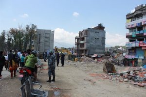
In contrast, by the time the earthquake stuck Nepal the use of social media and crisis maps had evolved. A lot had been learned from Haiti and local internet groups led the digital response by analysing social posts immediately after the earthquake and located them on maps that were accurate due to the months and years prior that had been spent on tracing satellite imagery of Kathmandu and Nepal to ensure every road and dirt path had been mapped. However because of the remoteness of villages in the mountains and the lack of road accessibility, most of the initial relief was done through helicopter. Social media and crisis mapping played their roles in providing information for this type of response. Facebook and twitter provided information about the needs in remote villages and to organize helicopter times, while crisis mappers sifted through satellite imagery of Nepal to find suitable helicopter landing spots near villages and map them. The biggest difference between Haiti and Nepal is the number of images embedded in Twitter and Facebook posts, and the number of posts that had the specific location of an incident increased exponentially, which made these posts particularly valuable.
In disaster relief, information is just as important as food relief or shelter. NGOs need to provide information to locals about relief efforts, but it is also important for NGOs to use the huge amount of information provided by local populations, as it can provide actionable intelligence that can be used to plan and execute relief operations more efficiently. Social media can be that source of information and that method of communication. Crisis mappers can locate and visualise the information from these posts and this can be such an invaluable resource for relief organisations.


0 Comments