Participatory mapping for local green routes | Joanna Barrow
Encouraging active travel and supporting community health and wellbeing through the co-production of local green routes with local community partners | Joanna Barrow, Manchester Urban Institute
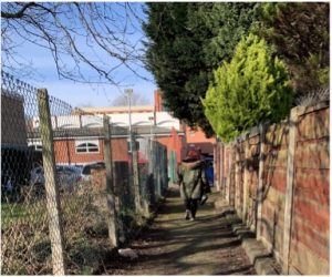
The previous blog in this series outlined good practice for community co-production of research. One important aspect of this work is the method of engagement, i.e. finding effective ways to work collaboratively with local stakeholders. This blog presents an example of how participatory mapping was used in research with the local community in Ardwick, close to Manchester city centre and the University of Manchester.
The context
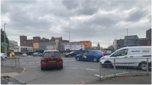 Ardwick is surrounded by busy dual carriageways (the A6, Mancunian Way and the A34). Air quality is a cause for concern for local activist group, Ardwick Climate Action (ACA), as well as academics from the University. Working to raise awareness of air quality and other environmental issues, ACA has implemented a series of green projects to improve the area for local residents, for example by planting trees and vegetation to screen housing from the noise and pollution of the arterial roads.
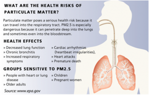
High levels of traffic pollution can increase the risk of poor health, for example for heart, lung and brain conditions. Traffic pollution is made up of a mixture of gases and solid particles (particulate matter). The very small particles are the biggest risk causing six to nine million premature deaths each year. Infants and young children are particularly vulnerable to the effects of air pollution.
 The World Health Organisation recommend that air pollution should not exceed 10 micrograms per cubic metre. Many towns and cities in the UK exceed this limit, including Manchester, last measured at 13 micrograms per cubic metre (2018).
Research
This study links directly with community green infrastructure development orchestrated by ACA, one of various projects focusing on air quality in the Ardwick area. The aim was to design a network of ‘green routes’ through Ardwick to: avoid the most polluted areas; contact 10 newly developed ‘green sites’; promote active travel (walking / cycling) rather than driving; and link into the wider travel networks, (footpaths, cycleways and public transport links).
Process
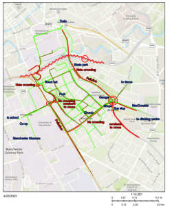 A participatory mapping exercise was used as a tool to explore how people travel around the local area and to explore broader issues relating to their travel experiences. Community residents were asked to draw their regular journeys around Ardwick on a large map, using different colours to represent different modes of transport (green = walk; brown = car; orange = public transport; blue = cycle). They were then asked to identify areas that people consider to be dangerous for pedestrians and cyclists (marked in red).
The activity was also intended as a means of engagement that would be accessible to a broad range of people to encourage discussion.
The mapping exercise was completed by a range of Ardwick residents at local community events facilitated by ACA. Members of the local Scout group, Brunswick Women’s Group and children and parents from Medlock Primary School also contributed. The maps were then digitised (ensuring all data were anonymised).
Green routes
Walking routes were drafted taking into consideration the following issues raised by local residents and informed by the mapping exercises:
- take in quiet streets
- take in places that are pretty / green / pleasant to sit
- take in places to visit, e.g., the Manchester Museum, cafes and shops
- avoid busy polluted roads
- avoid narrow alleyways (feeling unsafe / vulnerable)
- avoid areas without street lighting
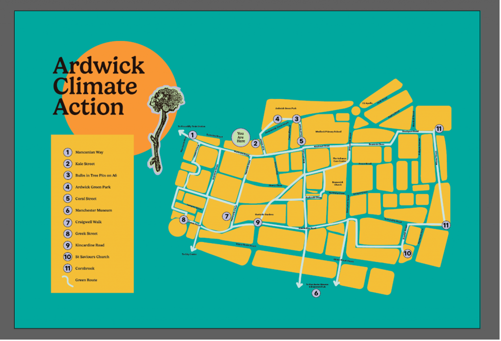
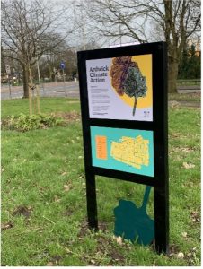
 The draft routes were reviewed by local residents and revised based on their feedback. Alongside the green route development, artist Sally Gilford was commissioned to design artwork for a series of signs displaying the map, which have now been installed in Ardwick. QR codes on the signs link to pages on the ACA website, providing local information including local history, wildlife and health information.
It is hoped that the green routes will promote positive health and wellbeing.
Useful links
Participatory mapping toolkit (Morgan Centre for Research into Everyday Lives)
Charting a path to clear air blog (Policy@Manchester)
Acknowledgements
 Thank you to research collaborators
- Ardwick Climate Action
- Professor Sheena Cruickshank
- Artist, Sally Gilford
- Members of the local community in Ardwick
Contact us
+44 (0) 161 306 6000
0 Comments